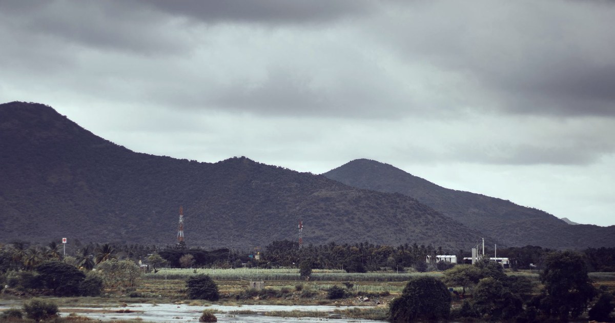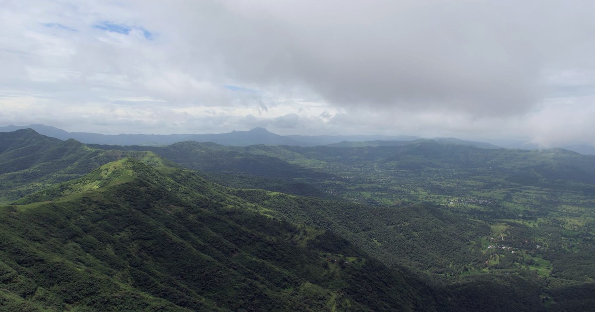
Every monsoon, India measures itself against one number. The India Meteorological Department states that its benchmark for a normal south-west monsoon, the long-period average computed over 1961 to 2010, is 880.6mm: the baseline against which every season's actual rainfall gets measured for reservoir, irrigation and drought planning. Meet or beat that number, and the season is read as normal or better. Falling short starts the drought conversation. It is a clean, simple accounting: total rainfall in, water available out.
It is worth slowing down on that assumption. Rain that forms inside a monsoon cloud does not all survive the trip down. Some of it evaporates back into the air on the way, and before a 2026 study measured it directly, nobody had put a number, for India specifically, on how much was lost that way each day.
The share that never survives the fall
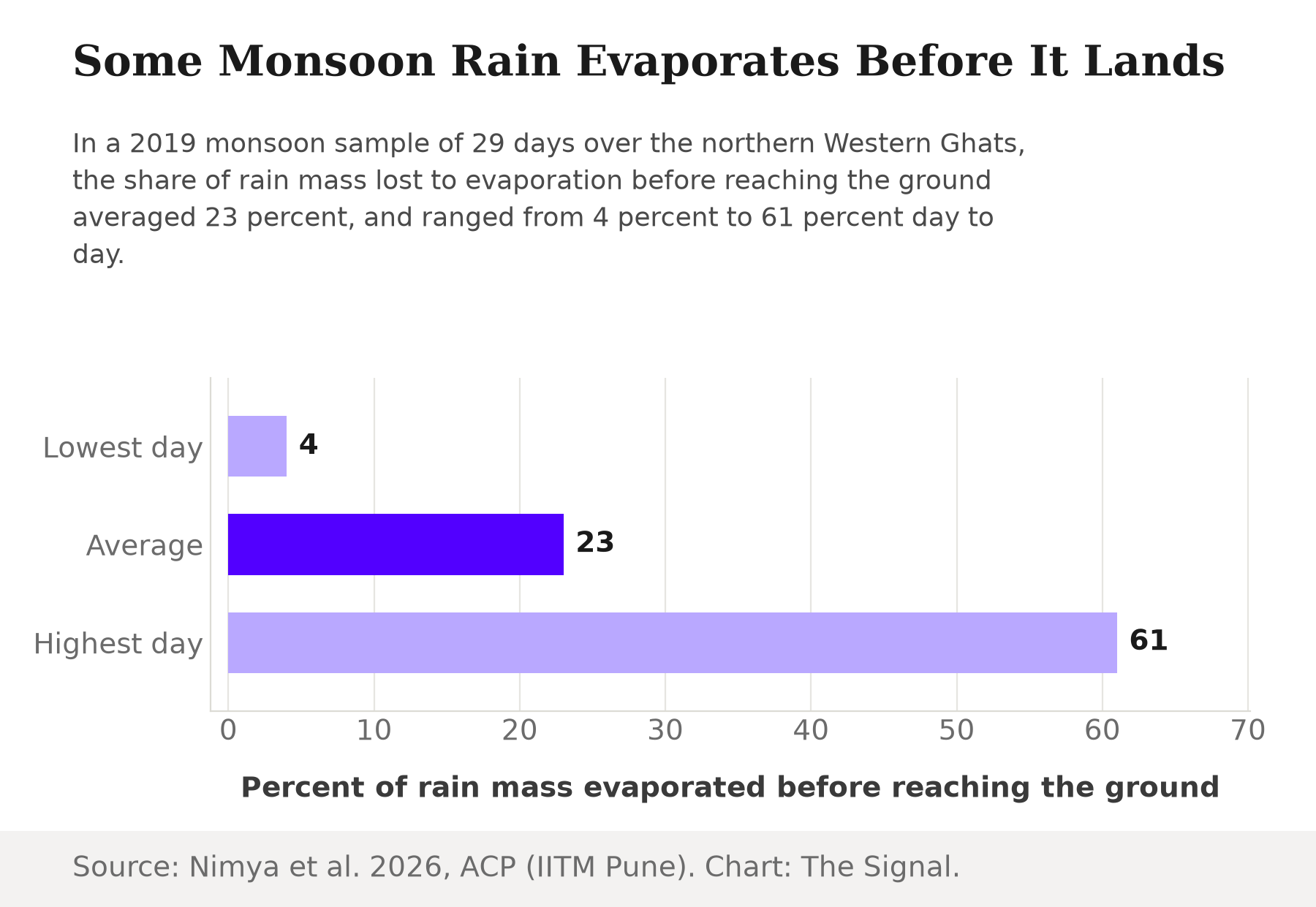
A 2026 peer-reviewed study answers that question directly. Researchers at the Indian Institute of Tropical Meteorology in Pune find that raindrop evaporation over the northern Western Ghats during the 2019 monsoon averaged 23 percent of the rain's mass on a daily basis, swinging from as little as 4 percent to as much as 61 percent across the 29 monsoon days they sampled. That is not a rounding error. On the wettest, most humid days, the air below the cloud is already saturated and almost none of the falling rain evaporates. The same cloud, under drier air, can lose well over half its rain before any of it reaches the ground.
Evaporation swung from 4 percent to 61 percent across 29 sampled monsoon days.
The mechanism is simple physics, not a flaw in anyone's rain gauge: a falling raindrop is a small, wet surface exposed to whatever air it is passing through, and drier air pulls more of that water back into vapor before the drop lands. The study's own numbers show exactly how much that matters. The same IITM Pune study estimates that on light-rain days, a 10-percentage-point rise in the evaporation fraction, say from 15 percent to 25 percent, cuts the rain that actually reaches the ground by about 4mm a day, from 5mm down to 1mm. A day that goes from 5mm to 1mm has lost four-fifths of its rain, for a change in air dryness that sounds almost trivial. A monsoon spell does not have to fail to produce a dry-feeling day. The air just has to get a little thirstier.
Why the loss matters more on the thin days
This is where the finding turns from a physics curiosity into something that touches water planning. A heavy, saturating downpour loses relatively little to evaporation, because the air is already wet. It is precisely the light, marginal rain days, the ones that decide whether a dry spell breaks or grinds on, where evaporation takes its heaviest toll. Those are also the days state water managers watch closely, because they are the swing days between "the monsoon is active" and "the monsoon has paused."
Rain that reaches the ground still has further to travel before it becomes usable water: into a river, a reservoir, or the soil an aquifer draws from. Whatever an evaporation spike removes from a light-rain day never gets the chance to do any of that.
That accounting is not academic this year. The Central Water Commission's weekly bulletin, as reported by Down To Earth, shows that India's 166 monitored major reservoirs held just 47.725 billion cubic metres of water, 26 percent of their combined 183.565 billion cubic metre live storage capacity, as of July 2, 2026, below both the year-ago level and the ten-year average. A quarter full is already a tight number for the middle of the monsoon. It is a reminder that some share of whatever rain the clouds still owe this season will not survive its own fall.
India's 166 major reservoirs are barely a quarter full, six weeks into the monsoon.
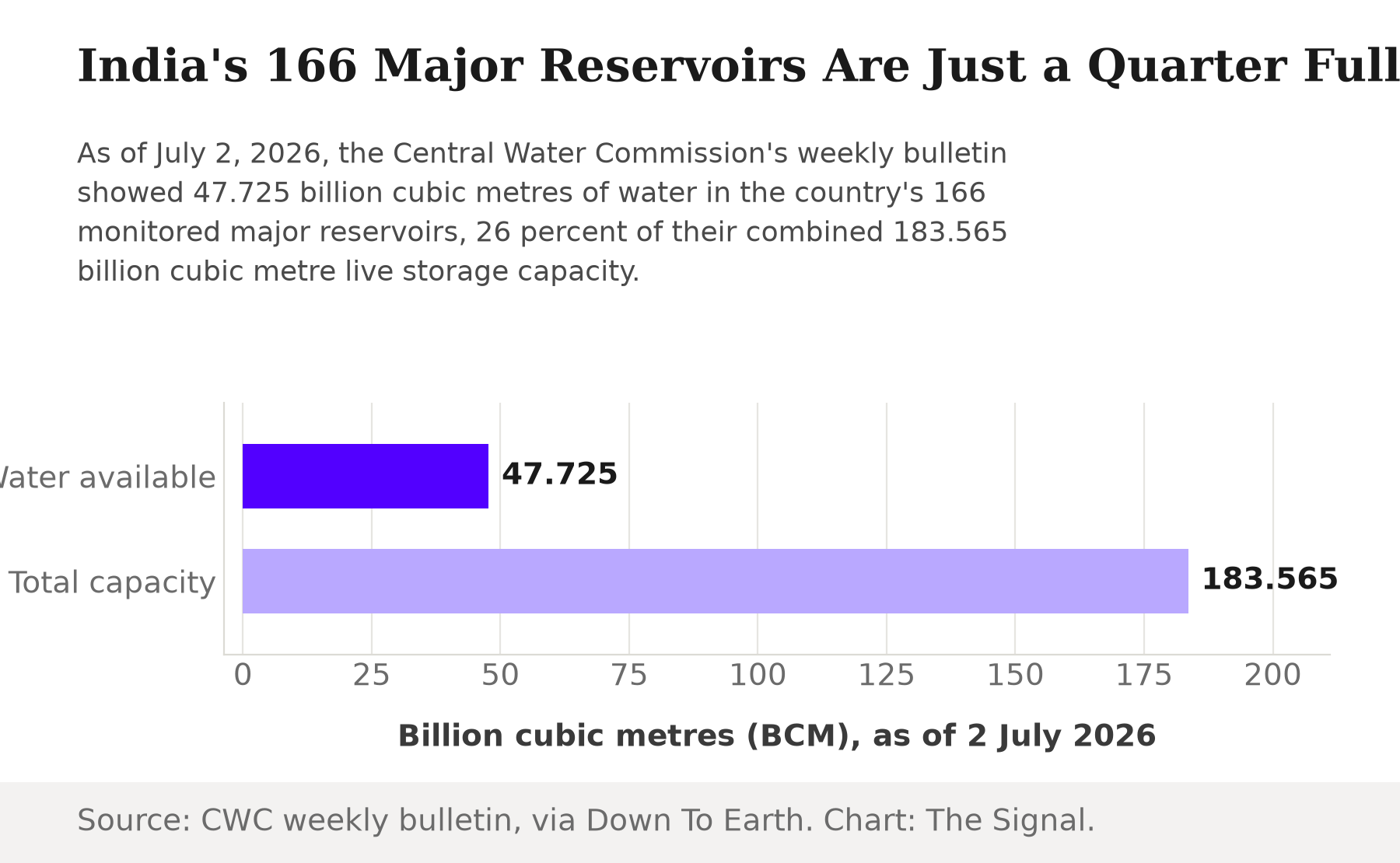
Source: Central Water Commission weekly bulletin, via Down To Earth.
The water accounting, side by side
| Benchmark | Figure | What it measures |
|---|---|---|
| IMD long-period average monsoon rainfall (1961 to 2010) | 880.6mm | The baseline every season's rainfall is compared against |
| Raindrop evaporation, Western Ghats, 2019 monsoon (29-day average) | 23%, ranging 4% to 61% | New peer-reviewed measurement of rain lost before it reaches the ground |
| India's 166 major reservoirs' live storage, as of 2 July 2026 | 26% (47.725 of 183.565 BCM) | Central Water Commission's weekly bulletin |
Sources: IMD; Nimya et al., 2026, ACP; CWC weekly bulletin, via Down To Earth.
The honest objection
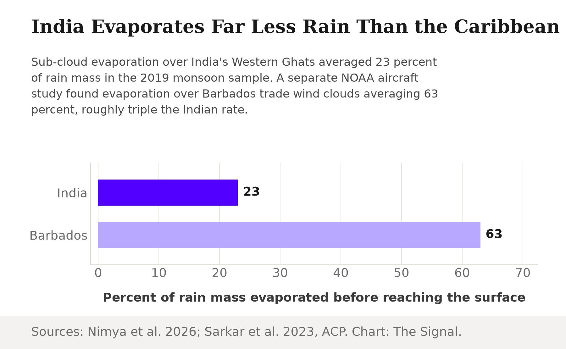
The strongest case for shrugging this off is that India's loss looks modest next to what the same physics does elsewhere. A 2023 study in Atmospheric Chemistry and Physics using NOAA aircraft data finds that in Barbados trade-wind clouds, sub-cloud evaporation consumes 63 percent of the rain's mass on average, roughly triple the 23 percent raindrop evaporation rate measured over India's Western Ghats. If Caribbean clouds routinely lose nearly two-thirds of their rain and nobody treats that as a crisis, a 23 percent average for India's monsoon can look like a rounding footnote by comparison.
India evaporates far less rain to the air than Caribbean trade-wind clouds do.
Sources: Nimya et al., 2026, ACP; Sarkar et al., 2023, ACP.
That comparison is real, but it compares the wrong things. Barbados's trade-wind clouds sit over open ocean: the moisture that evaporates back into the trade winds simply rejoins the same ocean it came from, with no dam or well downstream waiting on it. Every percentage point evaporated over the Western Ghats disappears from rain that was headed toward a specific catchment, reservoir, or aquifer, in a country where those reservoirs are already reading at a quarter of capacity. A loss rate being smaller than the Caribbean's does not make it costless when the land underneath is the thing running short.
The Signal
The sky is not a passive pipe between the cloud and the ground. It consumes some of its own rain before that rain ever counts, and it consumes the most on exactly the marginal, light-rain days that decide whether a monsoon spell holds or breaks. None of that shows up in the 880.6mm number IMD publishes each season. That figure reflects whatever fell at the gauge; what the cloud produced before the air took its cut goes uncounted. What the new Western Ghats measurements add is a way to see the cut itself: as small as 4 percent on a saturated day, as large as 61 percent on a dry one. With reservoirs already a quarter full in the middle of this year's monsoon, the number worth watching next is how dry the air is on the day the rain falls, not just how many millimetres come down.
Reporting basis: the raindrop evaporation measurements over the northern Western Ghats, including their full day-to-day range and the light-rain sensitivity figure, are from a single 2026 peer-reviewed study by Nimya and colleagues in Atmospheric Chemistry and Physics, based at the Indian Institute of Tropical Meteorology, Pune. The Barbados comparison is from a separate 2023 Atmospheric Chemistry and Physics study using NOAA aircraft data from the ATOMIC field campaign. India's long-period average monsoon rainfall benchmark is per the India Meteorological Department. Reservoir storage levels as of July 2, 2026 are from the Central Water Commission's weekly bulletin, as reported by Down To Earth. The four-fifths share lost when a day's rain falls from 5mm to 1mm, and the roughly-triple comparison between the Western Ghats and Barbados evaporation rates, are The Signal's calculations from those figures.